total: 1,285,216 sq km
land: 1,279,996 sq km
water: 5,220 sq km
Although Peru's seaboard is situated well within the tropical zone, it does not display an equatorial climate; average temperatures range from 21° C (70° F ) in January to 10° C (50° F ) in June at Lima, on the coast. At Cuzco, in the sierra, the range is only from 12° C (54° F ) to 9° C (48° F ), while at Iquitos, in the Amazon region, the temperature averages about 32° C (90° F ) all year round.
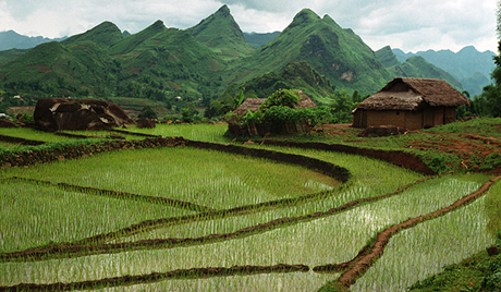
Peru, which varies greatly in climate and topography, falls into three main geographical regions—a narrow strip of desert along the coast, a region of high mountains in the center, and a large area of forested mountains and lowlands in the east
Land use: arable land: 2.84%
permanent crops: 0.66%
other: 96.5% (2011)
Total renewable water resources: 1,913 cu km (2011)
Peru was last measured at 6.84 in 2009
Natural hazards: earthquakes, tsunamis, flooding, landslides, mild volcanic activity in the Andes Mountains; Ubinas (elev. 5,672 m), which last erupted in 2009, is the country's most active volcano; other historically active volcanoes include El Misti, Huaynaputina, Sabancaya, and Yucamane
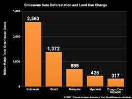
Environment current issues: deforestation, overgrazing of the slopes of the costa and sierra leading to soil erosion; desertification; air pollution in Lima; pollution of rivers and coastal waters from municipal and mining wastes
Labor force; total in Peru was last measured at 15475963.60 in 2010
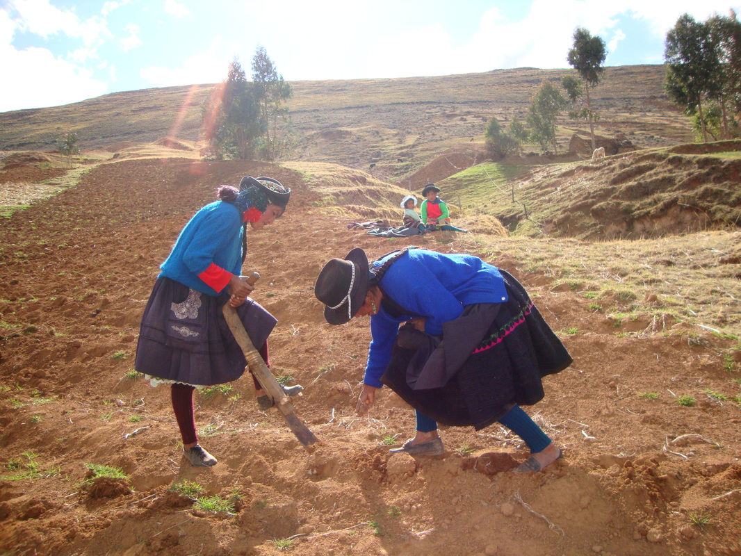
Agriculture products: asparagus, coffee, cocoa, cotton, sugarcane, rice, potatoes, corn, plantains, grapes, oranges, pineapples, guavas, bananas, apples, lemons, pears, coca, tomatoes, mangoes, barley, medicinal plants, palm oil, marigold, onion, wheat, dry beans; poultry, beef, pork, dairy products; guinea pigs fish
land: 1,279,996 sq km
water: 5,220 sq km
Although Peru's seaboard is situated well within the tropical zone, it does not display an equatorial climate; average temperatures range from 21° C (70° F ) in January to 10° C (50° F ) in June at Lima, on the coast. At Cuzco, in the sierra, the range is only from 12° C (54° F ) to 9° C (48° F ), while at Iquitos, in the Amazon region, the temperature averages about 32° C (90° F ) all year round.
Peru, which varies greatly in climate and topography, falls into three main geographical regions—a narrow strip of desert along the coast, a region of high mountains in the center, and a large area of forested mountains and lowlands in the east
Land use: arable land: 2.84%
permanent crops: 0.66%
other: 96.5% (2011)
Total renewable water resources: 1,913 cu km (2011)
Peru was last measured at 6.84 in 2009
Natural hazards: earthquakes, tsunamis, flooding, landslides, mild volcanic activity in the Andes Mountains; Ubinas (elev. 5,672 m), which last erupted in 2009, is the country's most active volcano; other historically active volcanoes include El Misti, Huaynaputina, Sabancaya, and Yucamane
Environment current issues: deforestation, overgrazing of the slopes of the costa and sierra leading to soil erosion; desertification; air pollution in Lima; pollution of rivers and coastal waters from municipal and mining wastes
Labor force; total in Peru was last measured at 15475963.60 in 2010
Agriculture products: asparagus, coffee, cocoa, cotton, sugarcane, rice, potatoes, corn, plantains, grapes, oranges, pineapples, guavas, bananas, apples, lemons, pears, coca, tomatoes, mangoes, barley, medicinal plants, palm oil, marigold, onion, wheat, dry beans; poultry, beef, pork, dairy products; guinea pigs fish